Wagad Sandstone Fm
Type Locality and Naming
The lower part of Wagad Sandstone is described from Kantkoti scraps and the upper part is described from Gandak village (Biswas, 1977)
Synonym: Wagad Sandstone
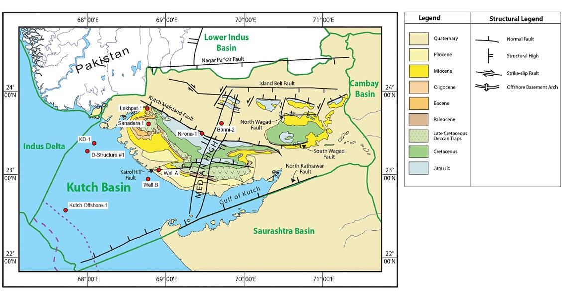
[Fig. Geological and structural map of Kutch, also showing the onshore and offshore wells drilled for oil exploration. (Map by Rasoul Sorkhabi in GeoExpro Dec2014, based on various sources including S.K. Biswas, Current Science, 25May2005)]
Lithology and Thickness
Sandstone. Dominantly coarse- to medium-grained felspathic sandstone with minor shale, locally with plant fossils. In the western Wagad, the lower part (Kanthkoti Member) contains shales and sandstone with marine fossils. The upper part (Gamdau member) consists of current-bedded felspathic sandstone with ferruginous sandstone bands with grey shale with plant fossils. In the type area it is +368 m.
Relationships and Distribution
Lower contact
Marked by a fossiliferous calcareous sandstone, red ferruginous band on the top of the thick underlying shale beds of Khadir Fm
Upper contact
Covered by recent sediments
Regional extent
GeoJSON
Fossils
Ptylophyllum sp. Astarte sp., Gryphea sp., Belminites sp. & Trigonia sp.
Age
Depositional setting
The upper part of the sequence in western Wagad and the entire sequence in eastern Wagad is fluviatile to deltaic. The lower part in western Wagad, however, is marine to sub-littoral.
Additional Information
